
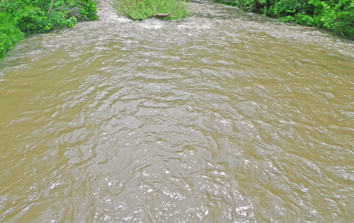
The North Fork of the Shenandoah River is currently in great shape at Strasburg, VA but upstream from Edinburg, VA to Fulks Run, VA there is a lot of water. The USGS Streamflow Gauges show that the river has reached it’s crest on both the Mt. Jackson Streamflow Gauge and the Cootes Store Streamflow Gauge. This is what we call “quick water”. Quick water leaves the area quickly because it fell in a short time frame and was not able to soak in. This doesn’t help the water table, it is mostly just a speed bump in the Smallmouth Bass Fly Fishing. Fortunately you can usually get ahead of or behind the extra water as it moves through the Shenandoah Valley.
The South Fork of the Shenandoah River is currently in great shape from Luray, VA downstream to the Potomac River. The USGS Streamflow Gauges show the river has reached it’s crest on the Lynnwood, VA Streamflow Gauge. This water will move through quickly as well but there is a lot of it.
The North Fork of the Shenandoah River and the South Fork of the Shenandoah River will both have “fishable” areas through the weekend. Give us a call if you need help determining where the extra water is or track it on the USGS Streamflow Gauges.
You must be logged in to post a comment.